Top 50 Wildfires in U.S. History

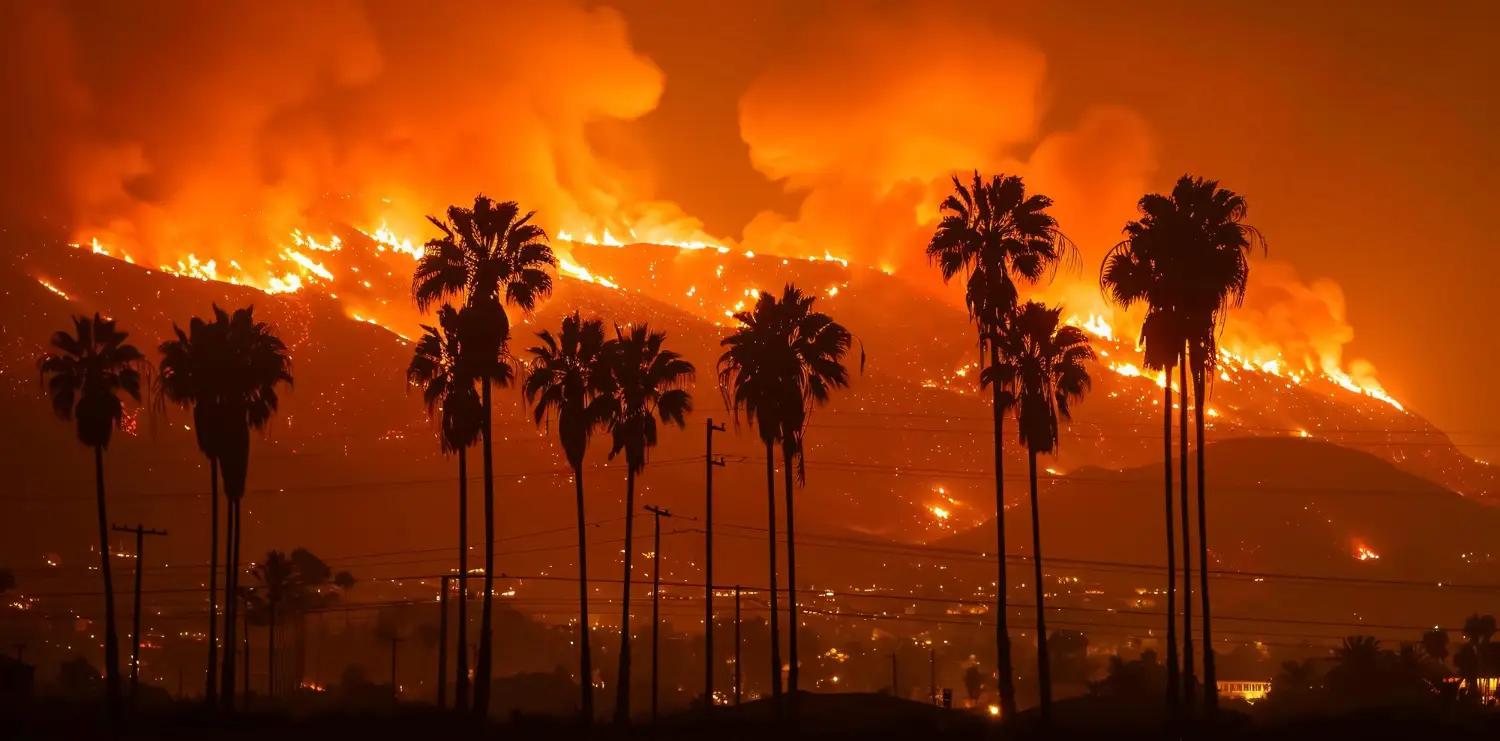
Fire investigators are not strangers to the unrelenting ferocity of wildfires. From spark to inferno, each blaze offers lessons and sometimes legacies for investigators. In this guide, we dig into the fifty largest wildfires in U.S. history by acreage.
Studying these cases that demand forensic precision. For every fire, we’ll map out the acres burned, cause, fatalities, and how, why, and where it all went wrong.
- 2000–2001 Western U.S. Wildfire Season
Location: Western United States (especially Idaho and Montana)
Area burned: 6.97 million acres
Fatalities: 4 firefighters
Structures: Numerous costs exceeded $2 billion
Cause: Multiple lightning and human ignitions amid record droughts
During the summer of 2000, massive fires erupted across the Northern Rockies under drought-stricken conditions and widespread lightning. Over 6.9 million acres burned, prompting a national emergency that enlisted military firefighting support. Four firefighters died in the chaos. The crisis reshaped interagency coordination, meteorological support systems, and led to the creation of the IMET and NWCG networks for large‑scale fire weather forecasting.
- 2020 California Wildfire Season
Location: Statewide, California
Area burned: 4.2 million acres
Fatalities: 33
Structures: 10,488 structures destroyed
Cause: Multiple lightning complexes and utility-related ignitions
California’s worst fire season on record was not defined by a single blaze, but by a cascading series of massive fire complexes sparked by dry lightning, extreme heat, and wind. Fires like the North Complex and LNU Lightning Complex stretched suppression capacity to its limit, while smoke impacts blanketed multiple states. The scale of destruction prompted changes in evacuation protocols, firefighter deployment strategy, and utility oversight across the state.
- 2011 Texas Wildfires
Location: Statewide, concentrated in Bastrop, Cass, and surrounding counties
Area burned: 4 million acres
Fatalities: 2
Structures: 3,000 homes and buildings
Cause: Human activity, electrical faults, drought
The 2011 wildfire season devastated Texas with thousands of ignitions sparked during one of the worst droughts in state history. The Bastrop Complex Fire alone destroyed more than 1,600 homes and underscored the threat of suburban development along the wildland–urban interface. These fires exposed weaknesses in mutual-aid response across rural counties and catalyzed changes in local emergency planning.
- Great Fire of 1910
Location: Northeastern Washington, Northern Idaho, Western
Area burned: 3 million acres
Fatalities: 87 (78 firefighters)
Structures: Several entire towns destroyed
Cause: Hundreds of small fires merged under extreme wind
The Great Fire of 1910 remains a defining moment in American wildfire history. After weeks of dry weather, hurricane-force winds fused dozens of lightning-sparked fires into a ferocious inferno that leveled towns and claimed the lives of entire fire crews. The scale of destruction prompted a fundamental transformation in federal fire policy, leading to the rise of aggressive wildfire suppression under the newly formed U.S. Forest Service.
- Great Michigan Fire (Oct 1871)
Location: Eastern and Northern Lower Peninsula, Michigan
Area burned: 2.5 million acres
Fatalities: Hundreds (exact number unknown)
Structures: Dozens of settlements wiped out
Cause: Dry weather and land-clearing fires
Happening simultaneously with Peshtigo, the Great Michigan Fire burned across millions of acres of forest and farmland. Wind-whipped flames overwhelmed local firefighting capabilities and left little time for escape. As with other fires of the era, it exposed the extreme vulnerability of 19th-century communities built within unmanaged, fuel-rich landscapes.
- Texas Smokehouse Creek Fire (Feb–Mar 2024)
Location: Texas Panhandle, including Hemphill County
Area burned: 1.1–1.2 million acres
Fatalities: At least 2
Structures: Hundreds of homes and ranch structures
Cause: Undetermined; fueled by extreme drought and high winds
The Smokehouse Creek Fire ripped through the grasslands of the Texas Panhandle with alarming speed, driven by sustained winds and dry fuels during an unusually hot winter. With flames spreading miles within hours, entire communities were forced to evacuate, and critical infrastructure, including a nuclear facility, was briefly threatened. The sheer scale of the fire redefined wildfire risk in southern plains ecosystems and demonstrated how rapidly fine fuels can escalate into record-setting disasters.
- Peshtigo Fire (Oct 1871)
Location: Peshtigo, Wisconsin
Area burned: 1.2 million acres
Fatalities: 1,200–2,500 estimated
Structures: Entire towns and settlements incinerated
Cause: Uncontrolled slash-and-burn land clearing
Overshadowed by the Great Chicago Fire that same night, the Peshtigo Fire remains the deadliest wildfire in U.S. history. Fueled by dry logging debris and driven by gale-force winds, the blaze created fire tornadoes and consumed entire communities in minutes. The lack of coordinated firefighting and the wooden construction of frontier towns contributed to the staggering death toll and enduring historical trauma.
- August Complex Fire (Aug–Nov 2020)
Location: Northern California (Mendocino, Tehama, Glenn, Lake, Trinity, Humboldt, Colusa counties)
Area burned: 1,032,648 acres
Fatalities: 1 firefighter
Structures: 935 buildings destroyed
Cause: Lightning strikes, 38 separate ignitions
This record-breaking fire, the largest in California’s history, was born from a flurry of lightning strikes that ignited dozens of blazes across rugged terrain. Over time, these fires merged into a sprawling megafire that overwhelmed resources and demanded coordination across multiple counties. Suppression efforts were hampered by steep landscapes, thick fuel beds, and extreme fire behavior, ultimately making it the first “gigafire” of the 21st century in the U.S.
- Dixie Fire (Jul–Oct 2021)
Location: Butte, Plumas, Lassen, Tehama, and Shasta counties, California
Area burned: 963,309 acres
Fatalities: 1 firefighter
Structures: 1,329 homes, 95 commercial structures
Cause: Electrical infrastructure; tree contact with PG&E line
The Dixie Fire ignited in the Feather River Canyon and quickly climbed into the Sierra Nevada, consuming the historic town of Greenville and burning for over three months. As California’s largest single-source wildfire, its explosive growth triggered widespread evacuations and reinvigorated scrutiny of PG&E’s role in repeated fire disasters. Investigators focused on terrain-driven fire spread, grid vulnerabilities, and the limits of modern containment strategies.
- East Amarillo Complex Fire (Mar 2006)
Location: Texas Panhandle (Randall and Potter counties)
Area burned: 907,245 acres
Fatalities: 12, including 4 in traffic accident due to smoke
Structures: 87 structures, 1,500 miles of fencing destroyed
Cause: Lightning and dry blizzard conditions
The East Amarillo Complex began with lightning strikes during a high-wind, winter-dry weather event, merging into massive grassland infernos that engulfed ranchlands and rural communities. Smoke reduced highway visibility to near zero, causing fatal traffic accidents. The fire destroyed thousands of miles of fencing, significantly impacting ranching operations. This incident highlighted the complex interplay between weather, fine-fuel management, and infrastructure vulnerability in investigator assessments.
- Yellowstone Fires (Jun–Nov 1988)
Location: Yellowstone National Park, Wyoming
Area burned: 793,880 acres
Fatalities: 2 civilians
Structures: Several park buildings and visitor centers
Cause: Multiple lightning strikes
The Yellowstone Fires of 1988 burned across a third of the national park, driven by the region’s driest summer in recorded history. Although controversial at the time, the fire ultimately became a case study in natural ecological recovery. The incident marked a turning point in how federal agencies approached fire policy, emphasizing the role of fire in ecosystem health even as suppression efforts mounted a $120 million campaign to defend key infrastructure.
- Long Draw Fire (July 2012)
Location: Southeastern Oregon (near McDermitt)
Area burned: 557,648 acres
Fatalities: 0
Structures: Ranch infrastructure and range fencing
Cause: Lightning strike on July 8, 2012
The Long Draw Fire ignited deep in the sagebrush of southeastern Oregon, triggered by lightning and fueled by years of dry grass and shrubs. It rapidly expanded through remote rangelands, overwhelming initial attack efforts and burning over half a million acres within days. Ranchers and BLM crews scrambled to erect firebreaks in a desperate race, but the blaze turned the landscape into a charred moonscape. It remains Oregon’s largest wildfire since 1865 and serves as a benchmark for studying fuel continuity and wildfire spread in arid ecosystems.
- Wallow Fire (May–Jul 2011)
Location: Apache-Sitgreaves National Forest, Arizona and New Mexico
Area burned: 538,049 acres
Fatalities: None reported
Structures: 72 homes and buildings
Cause: Unattended campfire
The Wallow Fire burned through Arizona’s high country for nearly two months, becoming the largest wildfire in the state’s history. Started by careless campers, the fire spread quickly through dry ponderosa pine forests and forced evacuations across multiple towns. The incident pushed fire officials to revisit backcountry camping regulations and examine long-term fuel management in forested recreation zones.
- Mendocino Complex Fire (Jul–Aug 2018)
Location: Mendocino, Lake, and Colusa Counties, California
Area burned: 459,000 acres
Fatalities: 1 firefighter
Structures: 280 buildings destroyed
Cause: Lightning-sparked twin fires (Ranch Fire and River Fire)
This complex ignited from simultaneous lightning strikes, producing twin front runners that merged into a single massive blaze. It held the title of California’s largest ever at the time and highlighted the challenges of managing multiple ignitions in heavily forested, inaccessible regions, stretching resources and prompting reconsideration of lightning-weather response strategies.
- Martin Fire (July 2018)
Location: Northern Nevada (Elko and Eureka counties)
Area burned: 435,569 acres
Fatalities: 0
Structures: Minimal rural losses
Cause: Undetermined ignition; fueled by dry grass after record spring rains
In July 2018, the Martin Fire erupted in northern Nevada’s basin-and-range grasslands, becoming the largest-ever blaze in the state. It raced across vast open terrain under hot, windy conditions, consuming over 435,000 acres before containment. Investigators concluded that an unknown spark met spring-burnished grass, resulting in explosive spread, highlighting that even seemingly benign ecosystems can unleash megafires under extreme conditions.
- Park Fire (Jul–Sep 2024)
Location: Butte and Tehama counties, Northern California
Area burned: 429,603 acres
Fatalities: 1 civilian
Structures: 709 destroyed, 54 damaged
Cause: Arson (vehicle spark in Bidwell Park)
On July 24, a burning vehicle in Chico's Bidwell Park ignited dry grasses, launching the Park Fire, which raced more than 400,000 acres across rugged terrain. It destroyed over 700 structures and prompted mass evacuations near Lassen National Forest. Driven by extreme heat and steep topography, the investigation centered on individual ignition responsibility and the challenges of arson-driven wildfires in densely populated wildland–urban interfaces.
- Anderson Creek Fire (Mar 2016)
Location: Kansas–Oklahoma border (Clark and Comanche counties)
Area burned: 367,620 acres
Fatalities: 0
Structures: Over 300 buildings destroyed, including homes and farm infrastructure
Cause: Undetermined spark in dry grassland
This massive grass-fire erupted spontaneously in mid-March and surged north through the Flint Hills under high wind and record dryness. Its speed overwhelmed volunteer fire departments, ripping through towns in a matter of hours. The blaze prompted a reevaluation of grassland fire prediction models and reinforced the importance of monitoring early-season fuel conditions in Plains states.
- Milford Flat Fire (Jul 2007)
Location: Juab County, Utah
Area burned: 363,052 acres
Fatalities: 0
Structures: Minor range structures and fences
Cause: Lightning
A remote lightning strike ignited the Milford Flat Fire, which roared through sagebrush and pinyon-juniper into a sprawling grassland expanse. The blaze was characterized by erratic behavior and rapid spread over sparsely inhabited terrain. Though structural losses were minimal, the fire offered critical data on large-area wildfire dynamics in mixed fuel types, informing subsequent suppression and aerial response tactics.
- Calf Canyon/Hermits Peak Fire (Apr–Jun 2022)
Location: Northern New Mexico (San Miguel and Mora counties)
Area burned: 341,471 acres
Fatalities: None
Structures: Hundreds of homes, ranch structures, and public buildings
Cause: Escaped prescribed burn
What began as a federal prescribed burn exploded into New Mexico’s largest recorded wildfire after unexpected wind shifts caused the fire to breach containment. As flames tore through private lands and cultural sites, thousands were displaced, and FEMA was forced to step in for long-term recovery. The fire sparked public outrage and lawsuits over government negligence in executing prescribed burns during known red-flag conditions.
- North Complex Fire (Aug–Sep 2020)
Location: Plumas and Butte Counties, California
Area burned: 318,000 acres
Fatalities: 16 civilians
Structures: 2,800 buildings destroyed
Cause: Lightning strikes amid extreme heatwave and drought
Under triple-digit heat and historic drought, lightning sparked dozens of fires that coalesced into the North Complex Fire. As flames swept through foothills and communities like Berry Creek and Feather Falls, evacuations failed to reach all residents. This incident has become pivotal for evaluating communication systems, early-warning inefficiencies, and heatwave-fire feedback loops.
- Okanogan Complex Fire (Jul 2015)
Location: Okanogan and Chelan counties, Washington
Area burned: 302,224 acres
Fatalities: 0
Structures: Hundreds of homes and farm buildings
Cause: Lightning
One year after Carlton, lightning storms sparked the Okanogan Complex, which again challenged fire managers with its rapid multiple-fire origins. Though losses were less than the prior year, this fire reinforced lessons about siting suppression lines, resource allocation in remote terrain, and building defensible spaces around at-risk rural structures.
- Thomas Fire (Dec 2017 – Jan 2018)
Location: Ventura and Santa Barbara Counties, California
Area burned: 281,893 acres
Fatalities: 2
Structures: 1,063 structures destroyed
Cause: Powerline failure
Fanned by relentless Santa Ana winds, the Thomas Fire scorched coastal canyons and hillside neighborhoods, forcing over 100,000 people to evacuate. Though initially suppressed near its origin, a re-ignition driven by wind gusts allowed the fire to surge across entire ridgelines. The fire’s aftermath was compounded by deadly debris flows triggered by rainfall on burned slopes in Montecito.
- Cedar Fire (Oct–Nov 2003)
Location: San Diego County, California
Area burned: 273,246 acres
Fatalities: 15 civilians + 1 firefighter
Structures: 2,820 buildings destroyed
Cause: Signal/spot fire during strong Santa Ana event
One of the most infamous wildfires in California history, the Cedar Fire was ignited by a lost hunter who set a signal fire during dangerous wind conditions. The blaze exploded overnight, consuming homes at a rate of one every 10 seconds and trapping residents attempting to flee. The incident led to major overhauls in evacuation protocol, fire weather forecasting, and wildland-urban interface development.
- Rim Fire (Aug–Oct 2013)
Location: Tuolumne County, California
Area burned: 257,314 acres
Fatalities: None
Structures: 112 homes and 98 outbuildings
Cause: Illegal campfire
The Rim Fire started on private land and swept into Stanislaus National Forest and Yosemite National Park, causing extensive damage to wildlife habitat and threatening one of San Francisco’s major water reservoirs. Though no lives were lost, the fire triggered a massive suppression effort and brought national attention to fire risks in the Sierra Nevada’s overgrown forests.
- Carlton Complex Fire (Jul 2014)
Location: Okanogan County, Washington
Area burned: 252,000 acres
Fatalities: 0
Structures: Hundreds of homes and outbuildings
Cause: Lightning
The Carlton Complex consisted of four separate lightning-ignited wildfires that merged to devastate North-Central Washington. Firefighters fought a rapidly advancing front that consumed entire subdivisions and rural properties. As Washington State’s largest historic fire, its unified spread prompted new wildfire response protocols and underscored the need for rapid interagency coordination across national forest and private lands.
- Carr Fire (Jul–Aug 2018)
Location: Whiskeytown–Shasta–Trinity, Shasta County, California
Area burned: 229,651 acres
Fatalities: 8 (including 3 civilians, 3 firefighters, 2 workshop personnel)
Structures: 1,604 buildings destroyed
Cause: Sparks from a vehicle tire failure, rim sparked edge vegetation
One afternoon in July, a vehicle’s blown tire rim struck pavement near Highway 299, igniting dry brush under extreme heat and wind. The fire produced a rare and devastating “fire tornado” with 143 mph winds that overtook crews and civilians in Redding. The Carr Fire tested suppression readiness, required deployment of thousands of resources, and cost an estimated $1.66 billion. The scale and ferocity of its turbulence are now critical case study material for fire behavior analysis.
- Las Conchas Fire (June–July 2011)
Location: Santa Fe National Forest and Bandelier National Monument, New Mexico
Area burned: 156,293 acres
Fatalities: 0
Structures: 63 residences, 49 outbuildings; 15 firefighting injuries
Cause: Aspen tree fell into a power line
A gust of wind on June 26, 2011, toppled a 75-foot aspen onto a power line, rapidly igniting the dense Santa Fe forest. Within 13 hours, over 44,000 acres burned; in total, it consumed more than 156,000 acres, becoming New Mexico’s largest fire at that time. The intense burn threatened the Los Alamos Lab and numerous cultural sites, raising alarms over the utility-landownership interface. The post-fire landscape also triggered severe debris-flow risks, prompting NRCS and NPS to launch watershed stabilization projects.
- Camp Fire (Nov 2018)
Location: Butte County (Paradise, CA)
Area burned: 153,336 acres
Fatalities: 85 civilians
Structures: 18,804 destroyed
Cause: PG&E electrical transmission-line failure under katabatic winds
California’s deadliest and most destructive fire ignited in the Feather River Canyon when an aging PG&E transmission tower failed, arcing live lines to the dry understory below. Fueled by fierce winds, the fire consumed entire towns within hours and devastated Paradise. The catastrophe triggered criminal pleas from PG&E executives, historic liability lawsuits, and reforms in utility vegetation management.
- Bighorn Fire (2020)
Location: Santa Catalina Mountains, Pima County, Arizona
Area burned: 119,987 acres
Fatalities: 0
Structures: 0 structures destroyed (minor infrastructure damage)
Cause: Lightning strike on Pusch Ridge
The Bighorn Fire ignited on June 5, 2020, following a dry lightning strike in rugged terrain above Tucson. Over the next six weeks, it crept and surged across nearly 120,000 acres of desert scrub and pine forest in the Santa Catalina Mountains. Although no structures were destroyed, the fire’s proximity to urban neighborhoods triggered prolonged evacuations and strained aerial suppression resources. Firefighters faced extreme heat, shifting monsoon winds, and steep topography, forcing repeated adaptations in containment strategy. The Bighorn Fire became a case study in managing wildland–urban interface threats in arid ecosystems with limited water resources.
- West Fork Complex Fire (Jun 2020)
Location: Hinsdale and Mineral Counties, Colorado
Area burned: 109,615 acres (West Fork + Papoose fires)
Fatalities: 0
Structures: None reported destroyed
Cause: Lightning
In the summer of 2020, a lightning storm ignited multiple fires in the remote San Juan Mountains. The West Fork Complex consumed over 109,000 acres across rugged terrain that limited ground crew access. Though structures were largely spared, the blaze generated extensive research on fire effects in alpine conifer forests and informed policies on backcountry fire use and watershed protection.
- Spring Creek Fire (Jun–Jul 2018)
Location: Costilla & Huerfano Counties, Southern Colorado
Area burned: 108,045 acres
Fatalities: None
Structures: 140 buildings destroyed
Cause: Lightning
Lightning ignited the Spring Creek Fire in Colorado’s remote southern forests, where drought and beetle kill had created dense fuels. While no lives were lost, the fire consumed 108,000 acres and over 140 structures, including backcountry infrastructure. Its slow-but-steady growth emphasized the hidden risk in high-elevation forests and triggered updates in detection and high-altitude fire suppression tactics.
- Woolsey Fire (Nov 2018)
Location: Los Angeles and Ventura Counties, California
Area burned: 96,949 acres
Fatalities: 3 civilians
Structures: 1,643 buildings destroyed
Cause: Faulty electrical equipment from Southern California Edison
Starting near the Santa Susana Field Lab, this fire quickly spread under intense Santa Ana winds, threatening Malibu and prompting the evacuation of nearly 300,000 people. Its urban-interface destruction of homes, businesses, and a major industrial site underscored the vulnerabilities of power infrastructure in wind-driven fires. Investigations led utilities to accelerate inspections and hardening of equipment in high-risk zones.
- High Park Fire (Jun 2012)
Location: Near Fort Collins, Larimer County, Colorado
Area burned: 87,415 acres
Fatalities: 1 civilian
Structures: 259 homes destroyed
Cause: Lightning strike
Lightning struck in dry mountain foothills, igniting the High Park Fire on June 9, 2012. Fueled by beetle-kill timber and hot, windy conditions, the fire shredded through nearly 90,000 acres, including parts of the Poudre River watershed. One fatality was reported, and over 250 homes were lost. Researchers later analyzed its impact on soil hydrology and watershed protection, prompting improved burn response strategies.
- Chips Fire (July–August 2012)
Location: Plumas National Forest, Northern California
Area burned: 75,431 acres
Fatalities: 0
Structures: 9 buildings
Cause: Human-caused ignition near Pacific Crest Trail
Striking in the steep Feather River Canyon, the Chips Fire burned through dense conifer and timber stands in late July 2012. Its origin near a popular trail meant heavy human and aerial engagement, with over 1,500 personnel battling it for more than a month. The fire spread rapidly downhill, showcasing how recreation-driven ignitions in extreme terrain complicate suppression efforts and highlight gaps in early detection approaches.
- Grand Canyon Dragon Bravo Fire (Jul 2025)
Location: Grand Canyon National Park, North Rim, Arizona
Area burned: Approximately 8,570 acres (Dragon Bravo); approximately 60,000 acres including White Sage
Fatalities: 0
Structures: Approximately 80 buildings destroyed, including Grand Canyon Lodge and wastewater plant
Cause: Lightning strike; managed fire that breached containment
The Dragon Bravo Fire began as a lightning-ignited burn in early July and was initially allowed to smolder under supervision until a sudden burst of wind and high heat on July 12 turned it into a fast-moving wildfire. It swept through historic tourist infrastructure and caused a hazardous chlorine gas leak when it reached a wastewater treatment facility. The blaze raised serious concerns about managed fire policies in National Parks, especially under volatile summer conditions, and triggered a public inquiry into the decision-making behind its initial hands-off approach.
- Little Bear Fire (2012)
Location: Lincoln National Forest, Lincoln County, New Mexico
Area burned: 44,330 acres
Fatalities: 0
Structures: 254 structures destroyed
Cause: Lightning strike
Igniting on June 4, 2012, from a lightning strike in the White Mountain Wilderness, the Little Bear Fire exploded across the Lincoln National Forest under high winds and critically dry conditions. Despite early detection and aerial response, the fire escaped initial containment and became the most destructive wildfire in New Mexico's history in terms of structures lost. Entire neighborhoods near Ruidoso were reduced to ash within hours, exposing gaps in real-time evacuation protocols and communication systems. The fire’s erratic behavior in steep terrain and mixed fuel types forced a reassessment of suppression tactics in forested mountain regions with nearby residential developments.
- Bastrop County Complex Fire (September 2011)
Location: Bastrop County, Central Texas
Area burned: 34,000 acres
Fatalities: Several (reports vary); 160 animals rescued
Structures: 1,500 homes and buildings
Cause: Suspected arson (several ignition points)
One of Texas’s worst wildfires, the Bastrop Complex Fire, erupted during a record drought and windstorms. It devastated nearly 1,500 homes in the Lost Pines forest and claimed multiple lives, including essential livestock losses. The fire ramped up scrutiny on arson in wildfire causes, interdependent urban-wildland vulnerability, and institutional wildfire relief efforts, leading to long-term coordination networks for recovery.
- Palisades Watch Group of Fires (Jan 2025)
Location: Hollywood Hills, Santa Monica, Malibu, Los Angeles County
Area burned: Approximately 28,000 acres combined (includes Palisades, Eaton, Sunset, Mountain)
Fatalities: At least 10 within LA-area wildfires
Structures: Over 10,000 destroyed
Cause: Santa Ana winds, embers, downed power lines, possible arson
This sweeping fire burned vast parts of the LA region, from upscale Malibu to the Hollywood Hills. Historic structures, including Will Rogers’s ranch, were lost. Mass evacuations, utility failures, and law enforcement coordination failures prompted criminal water-supply investigations and utility liability examinations, emphasizing the peril of mega-urban wildfires under wind extremes.
- Waldo Canyon Fire (Jun–Jul 2012)
Location: Colorado Springs and Pike National Forest, Colorado
Area burned: 18,247 acres
Fatalities: 2 civilians
Structures: 347 homes destroyed
Cause: Unknown, likely lightning or ember-triggered ignition
The Waldo Canyon Fire erupted just miles from downtown Colorado Springs on June 23, 2012, and exploded toward urban neighborhoods amid drought and high winds. It forced evacuations for over 30,000 people and destroyed 347 homes before full containment on July 10. With two civilian deaths and over $350 million in damage, the fire became a benchmark case in urban-interface mitigation, evacuation strategies, and community resiliency.
- Eaton Fire (Jan 2025)
Location: Altadena and Pasadena, Los Angeles County, California
Area burned: 14,021 acres
Fatalities: Included in 29 LA fire deaths
Structures: Thousands destroyed (combined LA fires)
Cause: Santa Ana winds and downed utilities
Initiating near Altadena, the Eaton Fire bulldozed across foothills and into suburban zones, destroying thousands of homes and critical infrastructure. Lightning-fast spread under 50–80 mph winds left residents little time to evacuate. Investigators highlighted issues in real-time hazard communication and structural mitigations against powerline-sourced ignition under wind extremes.
- Mountain Fire (Nov 2024)
Location: Moorpark & Camarillo Heights, Ventura County, California
Area burned: Approximately 10,400 acres
Fatalities: Not specified
Structures: High-end homes in Camarillo Heights destroyed
Cause: Extreme wind-driven ignition (Santa Ana conditions)
Ignited during a November Santa Ana wind event, the Mountain Fire charged into suburban neighborhoods, destroying luxury homes and overwhelming local fire capabilities. Its proximity to civilian infrastructure underlined the abrupt intensification wildfires can undergo in wind corridors penetrating urban fringes.
- Hughes Fire (Jan 2025)
Location: Castaic, Los Angeles County, California
Area burned: Approximately 10,000 acres
Fatalities: Included in LA totals
Structures: Part of the 16,000 lost in LA fires
Cause: Santa Ana wind event
This third ignition in the January 2025 LA firestorm burned the Castaic Hill area and fueled the evacuation of high-risk zones. Though fatalities were aggregated, the fire added pressure on firefighters already battling adjacent blazes. It underscored the systemic risk posed by simultaneous fires under extreme wind events.
- Thirtymile Fire (Jul 2001)
Location: Okanogan National Forest, Washington
Area burned: 9,324 acres
Fatalities: 4 firefighters
Structures: No major structures lost (forest land)
Cause: Escaped campfire in narrow canyon
An unattended picnic fire exploded in the steep Chewuch River Canyon on July 9. Within 24 hours, the fire trapped an entrapment crew of six personnel in catastrophic terrain. Four lives were lost despite multiple shelter deployments. The incident triggered fundamental changes in incident command procedures, escape-route planning, and crew training, solidifying those lessons into fire shelter protocols used nationwide.
- Yarnell Hill Fire (Jun–Jul 2013)
Location: Yarnell, Yavapai County, Arizona
Area burned: 8,400 acres
Fatalities: 19 firefighters (Granite Mountain Hotshots)
Structures: 129 homes and structures destroyed
Cause: Lightning strike
The Yarnell Hill Fire was sparked by lightning on June 28, 2013, during a period of extreme heat, high winds, and unstable atmospheric conditions. On June 30, the fire overran a crew of 19 Granite Mountain Hotshots who became trapped by a sudden wind shift and a failed escape route. It was the deadliest incident for U.S. wildland firefighters since 1933. The event prompted national reevaluation of entrapment protocols, crew deployment strategy, and communication gaps under fast-evolving fire behavior. The tragedy remains one of the most studied wildfires in firefighter safety history.
- Marshall Fire (Dec 2021 – Jan 2022)
Location: Boulder and Jefferson Counties, Colorado
Area burned: 6,200 acres
Fatalities: 2 civilians
Structures: 1,084 homes destroyed
Cause: Still under investigation (suspected power lines or equipment)
The Marshall Fire ranks as Colorado’s most destructive in terms of structure loss. Fueled by dry grass and driven by 100 mph winds during a December heatwave, the blaze raced across 6,200 acres in hours, destroying over 1,000 homes while only two lives were lost. It forced a rethink of how engineering, weather forecasting, and land-use planning intersect at the urban–wildlife interface.
- Orleans Complex Fire (July 2025)
Location: Del Norte and Siskiyou counties, Northern California
Area burned: Approximately 6,000 acres (by July 13, 2025)
Fatalities: 0 reported
Structures: Limited evacuations; infrastructure threatened
Cause: Lightning-driven ignition
As of mid-July 2025, the Orleans Complex, sparked by lightning in remote ridges, burned approximately 6,000 acres with zero containment, exacerbated by high heat and low humidity. While lightly populated, its expansion threatens critical watersheds and communities, prompting aggressive firefighting and preemptive evacuations, demonstrating proactive management ahead of full suppression.
- Hidden Pines Fire (Oct 2015)
Location: Bastrop County, Texas
Area burned: 4,582 acres
Fatalities: 0
Structures: 64 homes and additional buildings destroyed
Cause: Spark from farm tractor equipment cutting brush
This 2015 wildfire reignited concern in the Bastrop area when stray sparks from farming equipment ignited dry grasses during the fall drought. It raced through over 4,500 acres and destroyed dozens of homes, highlighting the ongoing threats posed by farm and ranch equipment in interface zones. The incident prompted reevaluation of equipment operations and local land-use advisories for seasonal fire risk elevation.
- Coffee Pot Fire (Aug 2024)
Location: Southwest Sequoia National Park, California
Area burned: 2,683 acres (peaked at approximately 4,552 acres)
Fatalities: 0
Structures: No major structures lost; minor outbuildings threatened
Cause: Lightning-ignited tree fall breaching containment
A lightning strike in August 2024 sparked the Coffee Pot Fire deep in Sequoia’s backcountry. While initially contained, a rolling, burning tree breached the line, expanding the fire to over 4,500 acres. Though far from homes, it tested suppression tactics in remote terrain and informed National Park protocols on monitoring internal tree collapse post-containment.
- Crabapple Fire (Mar 2025)
Location: Gillespie County, Texas
Area burned: Approximately 50 structures threatened; acre count ongoing
Fatalities: 0
Structures: Some outbuildings lost; evacuation advised
Cause: Under investigation; dry conditions, high winds
The Crabapple Fire has demanded evacuations in Gillespie County and damaged rural buildings. Responders are addressing red-flag conditions as they assess the ignition source, suspected to be mechanical or agricultural in nature. Monitoring these spring fires is crucial, as the season’s early ignition window extends due to shifting climate patterns.
- Sunset Fire (Jan 2025)
Location: Hollywood Hills, Los Angeles, California
Area burned: Approximately 50 acres (rapidly moved)
Fatalities: Not specified
Structures: Not specified (part of LA urban-interface burns)
Cause: High winds under Santa Ana pattern
Though small in acreage, the Sunset Fire demonstrated how quickly even minor ignitions can threaten iconic infrastructure, like the Griffith Observatory, and disrupt services across LA when combined with multiple ignition sources under severe wind conditions.
What These Fires Teach Us
Every wildfire tells a story. For investigators, it’s about ignition timing, wind speed shifts, landscape memory, missed triggers, and operational pivots that either held or fell apart.
From the catastrophic miscalculations in the Grand Canyon Dragon Bravo Fire to the devastating utility negligence behind Camp and Dixie, these 50 largest wildfires in U.S. history underscore that size alone doesn’t determine impact. Some blazes burned millions of acres with minimal casualties. Others like Yarnell Hill or Marshall took lives and entire towns in hours, despite relatively modest acreage. That’s where investigative focus sharpens.
So, what should you take forward?
- Ignition source matters, but how fuels and topography interact with wind is often the true accelerant.
- Power infrastructure and land-use planning remain recurring failure points, especially under climate-fueled weather extremes.
- Evacuation timing, public alert systems, and command coordination can turn a fast-moving fire into a mass casualty event or prevent one.
- And managed burns and prescribed fire policies, while essential, can become liabilities without airtight meteorological margins.
As suppression costs soar and fire seasons stretch into fire years, the role of the fire investigator evolves, too. You’re not just reconstructing past mistakes, but influencing future risk frameworks. Your job is to learn more about why it spread, who failed, what was missed, and what can’t happen again.


Trusted by Public and Private Investigator Teams Everywhere
Whether you're a big state agency, a small local fire department or somewhere in between, Blazestack software (NFPA 921® & CJIS compliant) collects fire scene data and generates standardized origin and cause reports in a fraction of the time of other methods.
To learn more about Blazestack, give us a call at (866) 303-4344 or email us at support@blazestack.com
Get Your Free 14-Day Trial and Custom Price Quote Now
We'll let Blazestack do the talking. Try it out right now for free.
A member of our staff will be in touch shortly.