A Comprehensive Guide to the Causes of a Wildfire: Prevention, and Investigation

If you're still thinking of wildfires as seasonal, something that flares up in the summer and disappears by fall, you're already a few steps behind. The truth is that wildfire no longer plays by the old rules. Acreage is up. Fire behavior is more erratic. Human ignition sources are surging. And suppression resources are stretched thin before peak season even begins.
As a fire investigator today, you're walking into a sprawling outdoor crime scene with political, environmental, and legal pressure swirling all around it. Understanding the causes of a wildfire requires you to know the science, read the land, interface with drones, decipher weather data, coordinate with utilities, collect evidence admissible in court, and write reports that will stand up against expert cross-examination, often months or years after the fire has cooled.
In this guide, we’ll cover the entire operational reference, from fire behavior fundamentals and wildfire ignition point analysis, to the latest tech tools, courtroom standards, and community-level prevention strategies.
Table of Contents
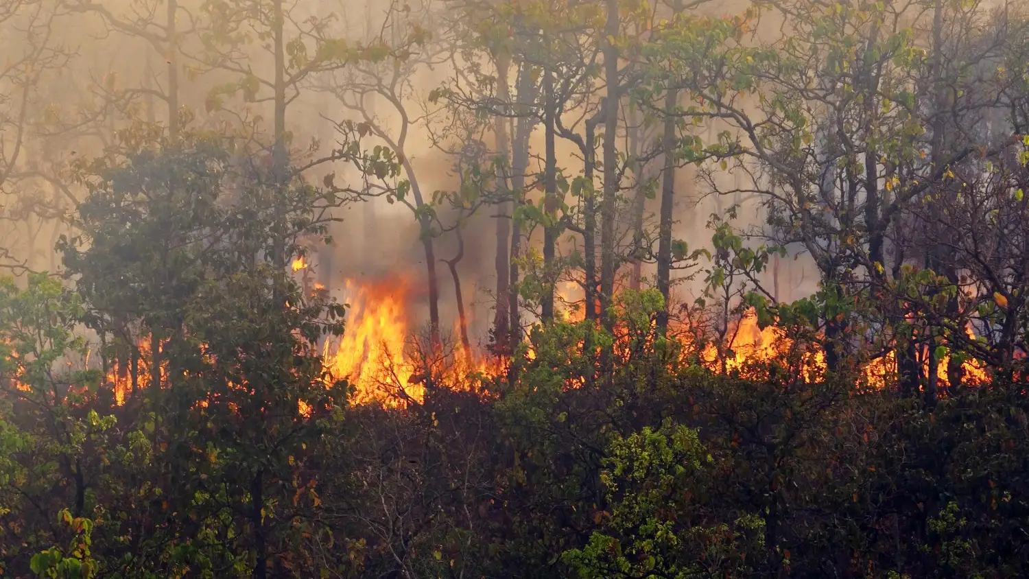
Wildfires are unplanned, uncontrolled fires in natural vegetation like grasslands, shrublands, forests, and even peat soils, driven by the classic trio of fuel, weather, and topography. Unlike prescribed burns, no one dictates their start time or boundary lines. Once ignited, they self-select direction and speed, reshaping the landscape minute by minute.
For investigators, that distinction matters. A wildfire’s “room of origin” can span acres, its walls shift with every wind gust, and its ceiling might be a 200-foot plume. Understanding that dynamic canvas is step one. Everything that follows, such as ignition clues, burn patterns, suppression impacts, makes sense only when you frame the incident as a living, moving system powered by continuous fuels and an atmosphere in flux.
As of early February 2026, the U.S. has already logged over 61,000 acres burned, continuing the relentless pace established in recent years. In 2025, the nation recorded approximately 44,470 fires that scorched roughly 4 million acres by late summer, with particularly severe activity in California's Sierra Nevada foothills and Oregon's Cascade Range.
The January 2026 Southern California fires, including the devastating Palisades Fire (23,707 acres) and Eaton Fire (14,021 acres), killed at least 31 people officially—though independent studies suggest the death toll may be significantly higher—and destroyed over 16,000 structures, ranking among the most destructive in state history.
Federal suppression spending mirrored the surge. The Interior Department alone dropped $4.79 billion on suppression in FY 2024.
Why the spike?
- Longer zero-snowpack periods extend the curing of fine fuels.
- Climate change has increased the probability of extreme fire weather conditions, with 2025 seeing temperature anomalies +1.5°C above normal across the western U.S.
- By mid-2025, nearly 45% of the western United States was under severe to exceptional drought conditions, with live fuel moisture dropping below 70% and dead fuel moisture falling below 5%.
- Drought and insect-killed timber turbo-charge flame lengths.
- The Wildland–Urban Interface (WUI) grows by approximately 2 million acres a year, piling structures into fuel beds.
- As of January 2026, 69% of the United States was under drought conditions, marking the highest coverage since 2000.
If you’re writing reports that still cite a “typical fire season,” juries and peers will spot the anachronism.
The big fires don’t just happen. They erupt when three environmental gears lock into the perfect, combustible alignment. Every blow-up, slop-over, or spotting run you’ll ever document traces back to the Fire-Behavior Triangle, which is the constant interaction of fuels, weather, and topography.
Think of the triangle as a three-dial safe. Turn any dial far enough, and the door swings open for extreme fire behavior. Your job is to record how far each dial was turned at the moment of ignition, and how those settings changed during the burn period.
Fuel
As an investigator, these are the fuel nuances you should record as part of your investigation:
- Model: Anderson’s 13 fuel models are still cited in court, but many agencies now default to the 40 Scott-Burgan set. Note which system you use.
- Continuity: A patchy cheatgrass field acts like kindling; continuous chaparral is a Roman candle. Describe horizontal and vertical continuity.
- Moisture: One-hour fuels (<¼-inch diameter) drop below 6 % moisture after just a few hours of single-digit humidity. Include those numbers, not the adjective “dry.”
Weather
The usual suspects, wind speed and relative humidity, get plenty of ink. Stability often doesn’t. The Haines Index, a stability-plus-dryness score from 2 to 6, is still a go-to shorthand for plume-dominated fire potential despite debates over its precision. A reading of 6 signals an unstable, bone-dry lower atmosphere, which are prime conditions for column-building and long-range spotting.
Record the index alongside winds and RH to show you’re tracking all three atmospheric levers.
Topography
Slope and aspect never change mid-fire, yet they amplify every gust and every ember:
- Steep, concave drainages accelerate upslope winds and pre-heat fuels. Note slope % and curvature.
- South-facing aspects cure earlier; list them when explaining unusual pre-green-up fires.
- Saddles and chimneys funnel winds. Map them with UAS lidar so jurors can see the blower effect.
Tie topography back to fuels and weather. A 30 mph downslope wind over cured cheatgrass on a 40 % grade is a different beast than the same wind over moist oak on a north-facing bench.
Before you hunt the point of origin, know which causes dominate the wildfire landscape.
Natural Ignitions
Dry thunderstorms often pepper remote ridgelines with dozens of strikes in minutes. Crews are hours away, fuels are tinder-dry, and a smoldering duff layer can hide flame for days before winds wake it up.
Document:
- Strike confirmation: Pull and archive National Lightning Detection Network (NLDN) logs.
- Physical evidence: Photograph fulgurite tunnels and bark flashes in situ before cutting anything.
- Weather linkage: Check how it ties to the Fire-Behavior Triangle. Did instability turbo-charge a hold-over into a plume-dominated blow-up?
Human-Caused Ignitions
Humans spark the vast majority of U.S. wildfires. Break the category into four practical buckets and look for these tell-tale patterns.
Power and Utilities
- Mechanisms: conductor slap, vegetation contact, blown fuses, or leaning poles. These events create different types of fault currents that can drop molten metal into dry grass.
- First records to secure: SCADA re-close logs, wind-gust data, maintenance history.
- On-scene clues: molten aluminum beads, candy-striped conductor metal, arc pits on porcelain.
Recreation
- Mechanisms: unattended campfires, fireworks, target shooting with steel-core ammo, OHV exhausts over grass.
- First records to secure: holiday visitor logs, social-media geotags, burn-ban status.
- On-scene clues: charcoal rings, aluminum bullet spatter on rocks, melted plastic primers.
Industry and Agriculture
- Mechanisms: welding, grinding, slash-pile escapes, harvest equipment sparks.
- First records to secure: hot-work permits, pile-burn authorizations, operator statements.
- On-scene clues: fresh slag beads, linear ignition line matching machinery path, scorch marks under combine headers.
Intentional and Arson
- Mechanisms: multiple origins, trailers, chemical initiators.
- First records to secure: prior arson case files, highway-camera footage, cell-tower pings.
- On-scene clues: evenly spaced ignition points, accelerant odor, fuse timers, unusual match debris.
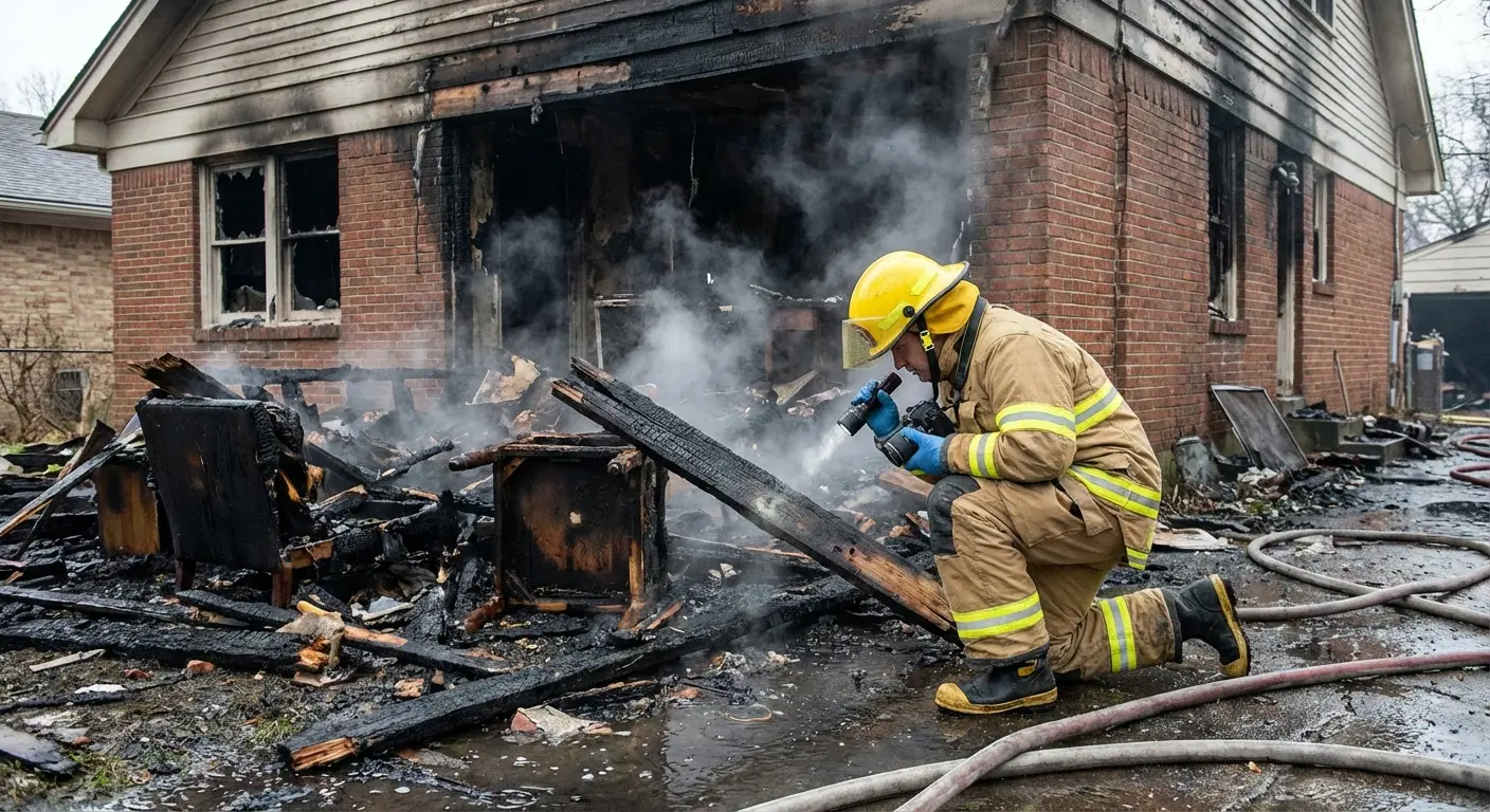
You can’t control when or where a fire starts, but you can control how soon you get eyes and boots on it. Those first 30–60 minutes dictate how crisp your charcoal patterns will be, how intact your artifacts remain, and how believable your ignition timeline sounds in court.
First Alert Sequence
Here’s the sequence of events you’ll typically see once a wildfire is detected:
- Alert lands in dispatch: Whether it comes from a lookout, a 911 caller, or an automated sensor, the clock starts now.
- Resource order goes out: Closest engine, hand crew, and air attack are launched.
- Size-up en route: IC scans weather, fuel model, access points, and potential values at risk.
- Tactical briefing on arrival: IC and ops agree on objectives: life safety, structure protection, and origin preservation.
- Line construction begins: Bulldozers, engines, and hand tools start changing the landscape, often right where your evidence lives.
Every step is timestamped in CAD logs or radio recordings. Grab those records early because they’ll become the chronological spine of your narrative.
The Investigator’s Early-Arrival Playbook
- Embed when possible: If staffing allows, ride with the first engine or follow close behind. Your presence reminds ops to carve a buffer around the suspected ignition area.
- Secure a “no-disturb” perimeter: Quick flagging or caution tape buys you time before line construction rolls through.
- Capture the virgin footprint: Even a 360-smartphone video or a half-dozen geotagged photos can freeze the scene in time if you can’t launch a drone immediately.
- Coordinate with ops: A two-minute huddle with the Incident Commander saves hours of evidence rehab.
- Bag the comms: Request CAD printouts, initial air-attack notes, and radio audio before fatigue or file purges set in.
- Archive the coverage: Local news reports often capture timestamped details, quotes, and footage that vanish or get edited within days. See our wildfire news resources hub for state-by-state media sources worth monitoring early.
Your mission as an investigator is twofold:
- Lock down time: Who moved what, and when
- Lock down space: Where every shard of charcoal, bead of metal, or bark scorch sits right now.
Below is a field-tested checklist that keeps seasoned fire investigators from stepping on their own evidence:
- Control the clock: Post a log board. Document every entry, exit, and tactical shift.
- 360-degree video sweep: Body-cam or UAS before a single flag drops.
- Flag inward, rake outward: Work from the least-damaged fuels toward the heat column to avoid trampling charcoal deposition evidence.
- Parallel documentation: Sketch, photo, GPS tag each artifact before removal.
- Utility liaison embed: If power lines are suspect, have the utility’s forensic engineer on-scene to expedite lock-outs and preserve energized evidence.
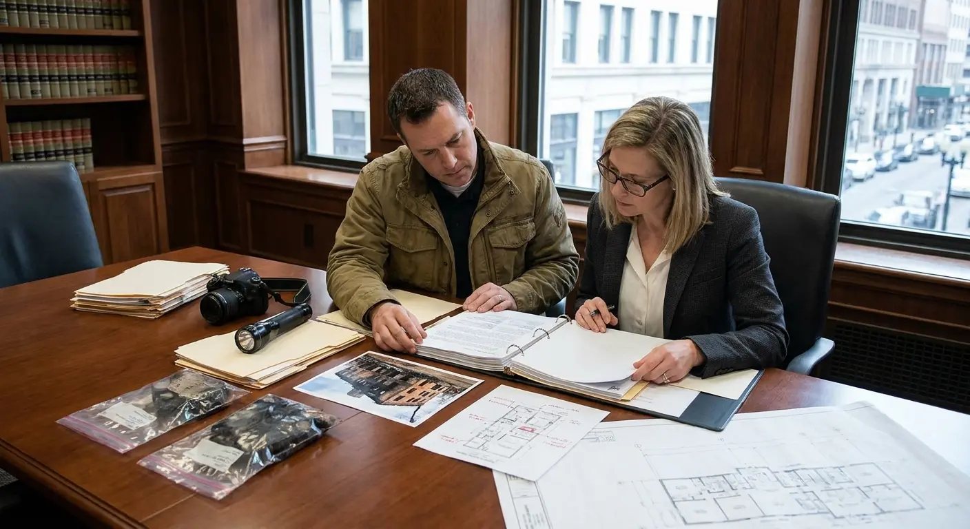
Your origin grid is flagged, photographed, and sketched. Now comes the evidence transfer, where even good investigations can fail. A perfect hypothesis can unravel because a charcoal fragment disintegrated in a plastic bag or a conductor bead lost its oxide skin under sloppy forceps. Chain of custody is the lifeline that carries your scene narrative all the way to the courtroom.
Think of the journey in three phases:
- Stabilize it in the field: Protect fragile surfaces, prevent cross-contamination, and record exact GPS coordinates before you budge anything.
- Package for transport: Choose containers that match the evidence. Rigid tubes for metal, breathable paper for organics, chilled glass for volatiles.
- Document every hand-off: Log the date, time, person, and purpose each time evidence changes custody. Digital media deserves the same rigor as a fuel sample.
High-stakes fire scenes demand more than a rake and a notebook. Below is a quick-hit gear guide with tools that deliver the biggest return for origin-and-cause work without burying you in complexity.
Even the sharpest origin report can’t undo acres already lost. Here’s a quick look at strategies for keeping the next burn from starting:
- Create Ember-Proof Buffer Zones: 10 to 50 feet “zero flame” rings, gravel strips, and irrigated green belts.
- Harden Structures: Class-A roofing, 1/8-inch vent screens, non-combustible siding, and tempered-glass windows.
- Underground or Shield Critical Lines: Bury priority circuits in high-threat corridors; where that’s impossible, add spark arresters and fast-trip smart relays.
- Leverage Real-Time Detection: Camera networks and satellite alerts give crews a head start; pair them with automated text or push alerts to residents. Tie sensor data into dispatch CAD so size-up teams roll sooner.
- Run Prescribed-Burn and Mechanical-Thin Programs: Low-intensity burns and mastication remove ladder fuels, lowering flame lengths around communities. Schedule burns in shoulder seasons when fuel moistures and weather windows align.
- Fund Community Wildfire Plans: Tap federal grants to pay for defensible-space projects, shaded fuel breaks, and evacuation-route hardening.
- Educate and Enforce: Burn-permit systems, fire-weather signage, and on-the-ground outreach keep debris burns and campfires from slipping out of control.
Wildland fire investigation involves putting together a thousand volatile details into a single, defensible story. Master the first hour, and you freeze the scene before chaos erases its clues. Quantify every environmental lever so your narrative stands up when memory fades and lawyers circle. Preserve data like evidence because a corrupted file can undo six weeks of fieldwork. And finally, connect your findings to the community’s next steps for a chance to fund better grids, smarter alerts, and ember-proof neighborhoods.
Do all that with rigor and curiosity, and the wildfire’s arc will become a map future crews can follow, a benchmark for prosecutors, and a quiet nod of respect from every investigator who reads your work.
For concrete examples of how these ignition sources and investigative challenges have played out in practice, see our breakdown of the 50 largest wildfires in U.S. history.
Related Blogs

Trusted by Public and Private Investigator Teams Everywhere
Whether you're a big state agency, a small local fire department or somewhere in between, Blazestack software (NFPA 921® & CJIS compliant) collects fire scene data and generates standardized origin and cause reports in a fraction of the time of other methods.
To learn more about Blazestack, give us a call at (866) 303-4344 or email us at support@blazestack.com
Get Your Free 14-Day Trial and Custom Price Quote Now
We'll let Blazestack do the talking. Try it out right now for free.
A member of our staff will be in touch shortly.