What Is a Prescribed Burn? Definition and Investigator Best Practices

Prescribed fires are one of the most powerful tools in wildland fuel management, but they’re also one of the most misunderstood.
When they go as planned, they reduce fuel loads, restore ecosystems, and make suppression safer down the road. But when they escape, they can lead to a host of other problems for fire investigators.
Whether you’re auditing a burn that breached containment or just want to sharpen your investigative lens, this guide outlines 15 best practices that will help you contribute to safer communities.
Table of Contents
What Is a Prescribed Burn?
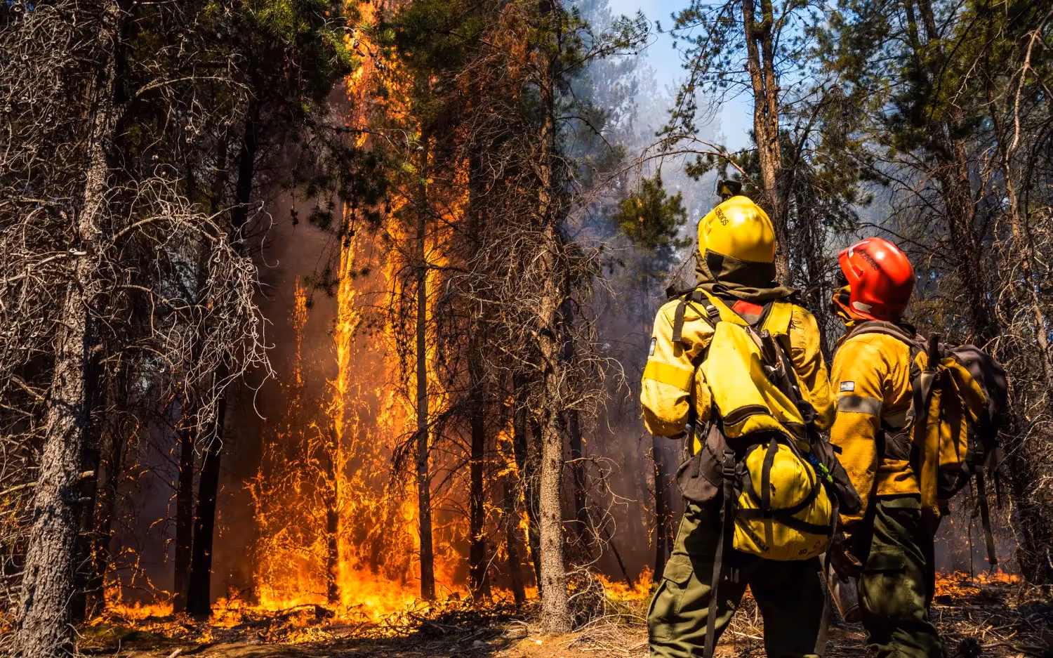
A prescribed burn is a fire intentionally set and closely managed by trained personnel to achieve a specific land management goal, typically reducing accumulated fuel to lower wildfire risk, restoring ecosystems that depend on periodic fire, or maintaining habitat for fire-adapted species. Every prescribed burn is planned in advance through a written burn plan, which defines the conditions, weather, fuel moisture, staffing, and containment measures, under which the fire is allowed to proceed.
"Prescribed burn," "prescribed fire," and "controlled burn" are used interchangeably across agencies and literature; there's no meaningful technical distinction between them, just differing institutional preference (federal agencies like the U.S. Forest Service and National Park Service tend to say "prescribed fire," while general usage more often defaults to "controlled burn"). All three refer to the same practice.
A prescribed burn differs from a wildfire in one essential respect: intent and control. A wildfire ignites unpredictably and spreads according to fuel, weather, and terrain alone. A prescribed burn is set deliberately, within a defined prescription window, and monitored by trained crews specifically to keep it within planned boundaries. When a prescribed burn moves outside those boundaries, it becomes what's known as an escaped fire, at which point it is investigated much like any other uncontrolled fire, with the added dimension of evaluating whether the original plan was sound and whether it was properly followed.
That evaluation is what the rest of this guide covers: 15 best practices investigators use to determine whether a prescribed burn was planned and executed the way it should have been, and where, if it escaped, things actually went wrong.
Before the first drip torch is lit, a written burn plan must exist, and it must hold up in court if challenged. This is your foundation. A defensible plan includes:
- Objectives tied to measurable fuel reduction or ecosystem goals
- Accurate maps showing fuel models and fire breaks
- Specific environmental prescriptions, like temp, RH, wind, and fuel moisture
- Staffing and equipment minimums
- Escape and contingency plans
- Multi-agency approvals
In most states, failure to adhere to the prescribed burn plan can result in civil or criminal penalties if the fire escapes. Fire investigators should always request the approved plan first.
Every prescribed burn should operate within a clearly defined environmental envelope, known as the prescription window. This includes specific ranges for temperature, relative humidity, wind speed and direction, fuel moisture, mixing height, and ventilation index. For example, RH might be limited to 30–55%, winds capped at 10 mph, and 1-hour fuels required to be above 7% moisture. These thresholds are operational and legal boundaries.
When a burn is ignited outside those conditions, it opens the door to control problems, liability, and scrutiny. Investigators should request both the forecast and actual weather data from RAWS or on-site Kestrel logs, then compare them to what was documented in the burn plan. If the conditions weren’t within the prescription and no amendment or justification was recorded, that’s a potential procedural violation worth flagging early.
The most reliable burn decisions are grounded in quantitative indices that reflect fuel conditions, atmospheric stability, and smoke dispersion potential. These metrics help predict how the fire will behave and how much margin for error you actually have.
Every prescribed fire plan should reference at least a few of these indices to justify the timing. If you're investigating a burn that went off-script, start here.
Common fire weather indices:
Every prescribed burn area should be physically walked, ideally within 24–48 hours before ignition. Here’s why it matters:
- Confirms topography matches maps
- Identifies unmarked hazards, like power lines, snags, and structures
- Validates fuel continuity and loading
- Assesses recent weather impacts like frost kill or precipitation
Fuel prep helps you control fire behavior before it starts. Check if fuel prep was completed on schedule and according to plan. Missed prep is a common factor in escaped burns.
Rake or cut around trees and cultural assets, and blackline key perimeters before the main ignition. You should also mow to break fuel continuity and clear around utility lines and structures.
The ignition pattern you choose determines flame length, rate of spread, and how much control you’ll have once the fire is moving. Terrain, fuel type, wind direction, and operational objectives all factor into the decision.
A poor match between ignition pattern and conditions is a common cause of fire escape. Every pattern carries its own risk profile. As an investigator, you should evaluate whether the chosen technique made sense for that specific day’s conditions.
Fire behavior can change within minutes, so monitoring real-time data is mandatory. Effective burn operations rely on multiple tools and observers working in sync. Monitoring should be structured, recorded, and responsive.
Monitoring tools should include:
- Kestrel handhelds for wind, RH, and temp
- Lookouts with radios
- Portable weather stations or RAWS feeds
- UAVs/drones with IR cameras for aerial views
- Paper logs or digital records updated every 30–60 minutes
A holding line is the last safeguard between a planned fire and a wildfire. And it’s not enough to scrape a shallow break and call it good. The line needs both width and depth, built to withstand shifts in wind, spot fires, and radiant heat.
Effective holding practices include blacklining 2–3 times the expected flame length, reinforcing vulnerable corners or terrain breaks, and assigning experienced personnel who understand how fire behaves under pressure. Junior igniters should never double as holding crews. Patrols must stay active, not just during ignition, but for 24 to 72 hours afterward, especially when wind or weather shifts are forecasted.
As an investigator, pay close attention to where and how a fire escaped. Was it a corner that failed? Were patrols stretched too thin? Most containment failures trace back to poor line construction or abandonment before the fire was fully secured.
Prescribed burns may be local, but their impact isn’t contained to the fireline. Smoke drift, road closures, and sudden visual alarms can trigger public panic, or worse, emergency calls that pull resources away from real threats. Proactive communication helps prevent false alarms, builds public trust, and gives responding agencies time to coordinate.
Successful burns start with a clear notification strategy that reaches every affected group. Agencies must:
- Notify dispatch and mutual aid departments
- Alert the public via signage, local media, and apps
- Coordinate with landowners, utilities, and ranchers
- Confirm burn windows with air quality boards
Large or high-risk burns often overlap multiple jurisdictions, such as federal, state, tribal, and local. They may also impact protected habitats or fall under restricted airspace. In these cases, failing to coordinate can halt operations, violate permits, or lead to public safety conflicts mid-burn.
Before ignition, agencies must confirm that all parties involved are aligned on objectives, maps, and roles. This level of coordination is especially critical when aircraft, wildlife protections, or cross-boundary fire behavior are in play.
Key checks:
- FAA notification for burns near flight paths
- Coordination with wildlife agencies
- Burn permits that cross county or state lines
- Smoke management plans filed with local or tribal air authorities
Anchor points are the foundation of any well-planned burn. These are non-burnable features, like roads, rivers, rocky outcrops, or previously blacklined areas, that give crews a safe place to begin ignition and hold fire. Without a solid anchor, even a well-resourced burn can unravel when fire behavior changes suddenly.
Investigators should always confirm whether the anchor point was clearly identified in the burn plan and actually used during execution. It’s equally important to determine if those anchor areas were patrolled and mopped up first, before attention shifted to active flame fronts. Fires that escape early in the operation often do so through weak or unpatrolled anchor points, especially under shifting wind conditions.
If there’s no documentation of how the anchor point was selected, secured, and maintained, that’s a red flag. Start there.
Re-ignition is a real risk days later if mop-up is shallow or rushed. Mop-up protocols should include:
- Digging 6+ inches to check for subsurface heat
- Using thermal imagers or IR guns to identify hotspots
- Cutting snags and extinguishing logs
- Recording perimeter checks for 24–72 hours post-burn
What does a “completed” prescribed burn look like? It looks like a binder or digital folder of records. Without the necessary documents, your credibility may take a hit. Documentation protects the agency and the burn boss.
Investigators should request:
- Ignition sequence maps and times
- Staffing and resource logs
- Weather observations during the burn
- Fuel moisture sampling reports
- Air quality compliance data, if required
After-action reviews (AARs) are how agencies learn and adapt. Every prescribed burn, whether smooth or problematic, should have a documented review. These reviews are essential for internal training and may be requested during litigation.
Look for what went well, what deviated from the plan, weather changes that affected execution, safety notes, crew performance, and lessons learned.
Prescribed burns often come under scrutiny months or even years later. Proper archiving ensures the evidence holds up. A good archive protects the agency and helps the next investigator trying to piece together what happened.
Here are a few best practices to follow:
- Store burn plans, maps, and logs in a centralized database
- Back up digital records with timestamps
- Maintain aerial or IR imagery for post-burn analysis
- Keep public notification records, like media alerts, and community emails
Prescribed burns are essential, but they’re not forgiving. From ignition patterns to mop-up patrols, every step matters. And when something goes sideways, investigators like you are tasked with reverse-engineering what failed, and why.
Was it sloppy planning? A rushed ignition? Did someone light up despite a high Haines Index?
Prescribed fire is a science. These 15 best practices can help you spot where it worked or where it all began to unravel.

Trusted by Public and Private Investigator Teams Everywhere
Whether you're a big state agency, a small local fire department or somewhere in between, Blazestack software (NFPA 921® & CJIS compliant) collects fire scene data and generates standardized origin and cause reports in a fraction of the time of other methods.
To learn more about Blazestack, give us a call at (866) 303-4344 or email us at support@blazestack.com
Get Your Free 14-Day Trial and Custom Price Quote Now
We'll let Blazestack do the talking. Try it out right now for free.
A member of our staff will be in touch shortly.